Baħrija + Tal-Mas
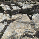
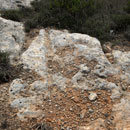
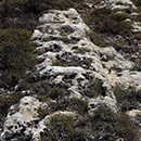
Around the village of Baħrija there are a lot of cart ruts, in total 36.
- Baħrija 1: 35.895531 14.344252, on the corner between the main and the secondary road
- Baħrija 2: 35.895594 14.344447, reasonably parallel to No.1
- Baħrija 3: 35.895233 14.345856, located in a small, undeveloped area in the north of the main road
- Baħrija 4: 35.894406 14.344756, located south of the school building
Baħrija east
Six stretches are located along Triq is-Saif, east of Bahrija.

- Baħrija east 1a: 35.894296 14.350752, probably connected with east 1b
- Baħrija east 1b: 35.894539 14.351511, poorly defined, covered over with vegetation
- Baħrija east 2: 35.894726 14.353999
- Baħrija east 3a: 35.894717 14.353786, forks 23 metres from the south-east end
- Baħrija east 3b: 35.894562 14.354101
- Baħrija east 4: 35.894425 14.354642, covered with vegetation
Baħrija north
South of Wied Gerżuma are three pairs of cart ruts.

- Baħrija north 1: 35.897943 14.348200, hardly visible, deteriorated
- Baħrija north 2: 35.897903 14.348149
- Baħrija north 3: 35.897543 14.349087
Baħrija north-west
Twelve shallow stretches running from N to S
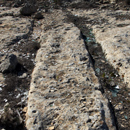
- Baħrija north-west 1: 35.898618 14.340548, eroded
- Baħrija north-west 2a: 35.898877 14.342038, formerly connected with No. 2b + No. 2c
- Baħrija north-west 2b: 35.898586 14.342359
- Baħrija north-west 2c: 35.898345 14.342586
- Baħrija north-west 3: 35.898905 14.341978
- Baħrija north-west 4: 35.898639 14.342310, intersect with No. 5
- Baħrija north-west 5: 35.898615 14.342403
- Baħrija north-west 6: 35.898404 14.342929, intersect with No. 7
- Baħrija north-west 7: 35.898434 14.342947
- Baħrija north-west 8: 35.897761 14.342892
- Baħrija north-west 9: 35.897161 14.342906, south end is covered with demolition debris
- Baħrija north-west 10: 35.897794 14.344219
Baħrija south
There are nine pairs of cart ruts on a rocky ground. Eight pairs run in a W-E, one in a N-S direction. Group 1 and 2 intersect and run into each other.

- Baħrija south 1a: 35.889616 14.346623
- Baħrija south 1b: 35.889611 14.346431
- Baħrija south 2a: 35.889600 14.346621
- Baħrija south 2b: 35.889600 14.346444
- Baħrija south 2c: 35.889583 14.346364
- Baħrija south 3: 35.889459 14.346509
- Baħrija south 4: 35.889137 14.346338
- Baħrija south 5: 35.889778 14.347906
- Baħrija south 6: 35.890908 14.351422
Baħrija south-west: 35.893589 14.343448, poorly defined
One pair leads down a slope in the south-west of the village
Baħrija west
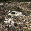
Six pairs of cart ruts are still visible.

- Baħrija west 1: 35.896319 14.342995
- Baħrija west 2: 35.896027 14.342838
- Baħrija west 3: 35.896486 14.341647
- Baħrija west 4a: 35.896471 14.341485
- Baħrija west 4b: 35.896449 14.341476
- Baħrija west 5: 35.896293 14.340872, interrupted by a stone wall
Tal-Mas
Seven pairs are located north of the group Baħrija west

- Tal-Mas 1a: 35.897608 14.340550, fans out into four pairs
- Tal-Mas 1b: 35.897142 14.340673, formerly connected with No. 1a, private property, not traced
- Tal-Mas 1c: 35.897611 14.340578, part of the fan
- Tal-Mas 1d: 35.897576 14.340523, part of the fan
- Tal-Mas 1e: 35.897576 14.340500, part of the fan
- Tal-Mas 1f: 35.897560 14.340491, part of the fan
- Tal-Mas 2: 35.897866 14.340121, 80 metre long, intersection with stretch No 3
- Tal-Mas 3: 35.897881 14.340158
Id-Dwejra
There are five pairs to the south of Dwejra lines, in an area with fields and tree plantations. The area is surrounded by walls, no access.
- Id-Dwejra 1: 35.905156 14.387739
- Id-Dwejra 2: 35.905250 14.387639, intersects No. 1
- Id-Dwejra 3: 35.905969 14.386233, intersects No. 4
- Id-Dwejra 4: 35.905939 14.385856
- Id-Dwejra 5: 35.905767 14.386255
East of Id-Dwejra 1-5, another group of cart ruts can be found.
- Id-Dwejra 6a: 35.905633 14.396222
- Id-Dwejra 6b: 35.905620 14.396197
- Id-Dwejra 7a: 35.905634 14.395979
- Id-Dwejra 7b: 35.905528 14.396223
- Id-Dwejra 8a: 35.905537 14.396232
- Id-Dwejra 8b: 35.905473 14.396655
- Id-Dwejra 9: 35.905551 14.396428
Il-Ħawlija: 35.894790 14.377752
A pair of cart ruts, interrupted by erosion, runs in N-S direction.

Il-Qolla
Shortly after the Binġemma Gap defensive bridge one pair is located on the left. Two pairs run parallel to the road and intersect at the NW end. 250 metres further to the east are two more pairs visible.
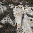
- Il-Qolla 1: 35.903051 14.378621
- Il-Qolla 2: 35.902855 14.378623
- Il-Qolla 3: 35.902796 14.378613
- il-Qolla 4: 35.902344 14.379110
- Il-Qolla 5: 35.902476 14.381658, interrupted by a rubble wall and bushes
- Il-Qolla 6: 35.902478 14.381631
Iskola ta Sant’Agata: 35.880806 14.394820
A pair of cart ruts is located near an ancient quarry and about 60 metres from St. Agatha School. Private property, no access.
Is-Slielem
A tangle of intersecting and interconnected cart ruts can be found north of Chadwick Lakes. Two sets running from W to E. They cross and are slightly curved towards the S. Seven sets cart ruts in NW to SE direction, two sets from E to W.
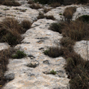
- Is-Slielem 1a: 35.893525 14.386632
- Is-Slielem 1b: 35.893578 14.385910
- Is-Slielem 2: 35.893936 14.384699
- Is-Slielem 3: 35.893919 14.384669
- Is-Slielem 4: 35.893792 14.384786
- Is-Slielem 5: 35.893851 14.384648
- Is-Slielem 6: 35.893825 14.384592
- Is-Slielem 7: 35.893610 14.384946
- Is-Slielem 8: 35.893394 14.384949
- Is-Slielem 9: 35.893387 14.384969
- Is-Slielem 10: 35.893397 14.385118
Ix-Xagħra ta’l-Għattuqa
There is another group of twelve sets to the east of the Qallilija cart ruts.
Ix-Xagħra ta’l-Għattuqa 1
Five parallel pairs run in E-W direction and curve slightly southwards.

- Ix-Xagħra ta’l-Għattuqa 1a: 35.901100 14.373791
- Ix-Xagħra ta’l-Għattuqa 1b: 35.901121 14.373794
- Ix-Xagħra ta’l-Għattuqa 1c: 35.901148 14.373799
- Ix-Xagħra ta’l-Għattuqa 1d: 35.901170 14.373805
- Ix-Xagħra ta’l-Għattuqa 1e: 35.901183 14.373813
Ix-Xagħra ta’l-Għattuqa 2 to 5
are located south of the road.
- Ix-Xagħra ta’l-Għattuqa 2: 35.900817 14.373219
- Ix-Xagħra ta’l-Għattuqa 3a: 35.900754 14.374135
- Ix-Xagħra ta’l-Għattuqa 3b: 35.900760 14.374166
- Ix-Xagħra ta’l-Għattuqa 4: 35.900666 14.374609
- Ix-Xagħra ta’l-Għattuqa 5: 35.900641 14.374909, heavily eroded
Ix-Xagħra ta’l-Għattuqa 6 and 7
Two pairs are further east from group No. 1, near a villa.
- Ix-Xagħra ta’l-Għattuqa 6: 35.900731 14.374919, poorly defined
- Ix-Xagħra ta’l-Għattuqa 7: 35.900761 14.374932, poorly defined
Ix-Xagħra tax-Xini
On either side of Triq is-Santi are several pairs of cart ruts, in total 17.

Ix-Xagħra tax-Xini 1
Four pairs of cart ruts running from SE to NW.
- Ix-Xagħra tax-Xini 1a: 35.896550 14.361094, interrupted by a stone wall
- Ix-Xagħra tax-Xini 1b: 35.896241 14.361258
- Ix-Xagħra tax-Xini 1c: 35.896272 14.361283
- Ix-Xagħra tax-Xini 1d: 35.896340 14.361317
Ix-Xagħra tax-Xini 2 and 3
Four parallel running pairs, three of which are on private land and cannot be traced.
- Ix-Xagħra tax-Xini 2: 35.894647 14.361614
- Ix-Xagħra tax-Xini 3a: 35.894664 14.361756, private property, not traced
- Ix-Xagħra tax-Xini 3b: 35.894647 14.361608, private property, not traced
- Ix-Xagħra tax-Xini 3c: 35.894633 14.361651, private property, not traced
Ix-Xagħra tax-Xini 4 to 7
Five pairs run down a slight slope, three slightly curved and two straight.
- Ix-Xagħra tax-Xini 4a: 35.894147 14.362045
- Ix-Xagħra tax-Xini 4b: 35.893797 14.362084
- Ix-Xagħra tax-Xini 4c: 35.894141 14.362085
- Ix-Xagħra tax-Xini 4d: 35.893970 14.362267
- Ix-Xagħra tax-Xini 4e: 35.893966 14.362318
- Ix-Xagħra tax-Xini 5: 35.893867 14.361403, private property, not traced
- Ix-Xagħra tax-Xini 6: 35.893631 14.361247, private property, not traced, probably rock-cut channels
- Ix-Xagħra tax-Xini 7a: 35.893871 14.360918, private property, not traced
- Ix-Xagħra tax-Xini 7b: 35.893858 14.360882, private property, not traced
Kunċizzjoni: 35.901222 14.349286
One set of cart ruts running in W-E direction. Heavily eroded on the eastern end.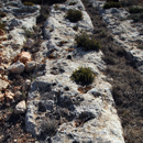
L’Andrijet
Four pairs of cart ruts are to the west, another pair to the south of L’Andrijet.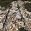
- L’Andrijet 1: 35.887431 14.363936, covered with soil and vegetation, barely visible
- L’Andrijet 2: 35.886749 14.364351, intersects No. 3
- L’Andrijet 3: 35.886753 14.364458
- L’Andrijet 4: 35.886716 14.364674
- L’Andrijet 5: 35.884119 14.366036
Qallilija
This area contains several groups of cart ruts.
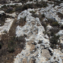
Qallilija 1
A network of 15 cart ruts opens in fan-like manner towards SE.
- Qallilija 1a: 35.900356 14.375793
- Qallilija 1b: 35.900355 14.375822
- Qallilija 1c: 35.900218 14.376115
- Qallilija 1d: 35.900452 14.375706
- Qallilija 1e: 35.900460 14.375717
- Qallilija 1f: 35.900461 14.375737
- Qallilija 1g: 35.900451 14.375772
- Qallilija 1h: 35.900454 14.375790
- Qallilija 1i: 35.900311 14.376160
- Qallilija 1j: 35.900412 14.375926
- Qallilija 1k1: 35.900374 14.376057
- Qallilija 1k2: 35.900391 14.376070
- Qallilija 1l: 35.900313 14.376285
- Qallilija 1m: 35.900297 14.376423
- Qallilija 1n: 35.900133 14.376840
Qallilija 2
Three sets run in a NS direction.

- Qallilija 2a: 35.900325 14.377132
- Qallilija 2b: 35.900321 14.377152
- Qallilija 2c: 35.900238 14.377199
- Qallilija 2d: 35.900226 14.377337
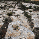
Qallilija 3
Six parallel pairs run in a NS direction, two of them slightly curved.
- Qallilija 3a: 35.900110 14.377772
- Qallilija 3b: 35.900037 14.377949, interrupted by erosion and vegetation
- Qallilija 3c: 35.900270 14.377867
- Qallilija 3d: 35.900017 14.378009, branches off No. 3a and flows into this set again after 38 metres
- Qallilija 3e: 35.900029 14.378049, interrupted by erosion and vegetation
- Qallilija 3f: 35.899895 14.378132, branches off No. 3c
Qallilija 4
An area with several cart ruts that cross and run into one another.
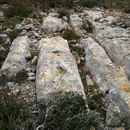
- Qallilija 4a: 35.899286 14.378133, formerly probably connected with No. 4b
- Qallilija 4b: 35.898894 14.375517, two consecutive sets, interrupted by a rubble wall
- Qallilija 4c: 35.898839 14.375884, intersects No. 4d
- Qallilija 4d: 35.898815 14.375860
- Qallilija 4e: 35.898600 14.375242
- Qallilija 4f: 35.898545 14.375238
- Qallilija 4g: 35.898544 14.375278
- Qallilija 4h: 35.898538 14.375295
- Qallilija 4i: 35.898535 14.375329
- Qallilija 5a: 35.898724 14.377731, runs along the southern edge of the quarry No. 5
- Qallilija 5b: 35.898399 14.378175, parallel to No. 5a
- Qallilija 5c: 35.898620 14.379080, runs near Triq Għajn Qajjet
- Qallilija 5d: 35.898672 14.379110, runs near Triq Għajn Qajjet
- Qallilija 6a: 35.897992 14.378872
- Qallilija 6b: 35.897678 14.379225, close to Triq Għajn Qajjet in E-W direction
- Qallilija 7a: 35.895176 14.381567, two sets, eroded in parts and covered by debris
- Qallilija 7b: 35.894886 14.381732
- Qallilija 8a: 35.893521 14.381020, partially clearly visible
- Qallilija 8b: 35.893689 14.382075, intersects with No. 8c, intersection is covered with vegetation
- Qallilija 8c: 35.893206 14.381689, slightly curved, runs in a NW-SE direction
- Ta’Paris 1: 35.891728 14.363194
- Ta’Paris 2: 35.891333 14.363617
- Ta’Paris 3a: 35.889810 14.363050, private property, not traced
- Ta’Paris 3b: 35.889781 14.363258, private property, not traced
- Ta’Paris 3c: 35.889785 14.363275, private property, not traced
- Ta’Paris 4a: 35.889585 14.364403, private property, not traced
- Ta’Paris 4b: 35.889587 14.364472, private property, not traced
Tal-Majjistra: 35.896339 14.372758 Two parts of a set are still visible.

Tan-Nadur new entries No. 2 – 9
There is a group of cart ruts in the Tan-Nadur area. The cart ruts No 2 – 9 were formerly probably connected with the group Ix-Xagħra ta’l-Għattuqa. The cart ruts No 4 – 9 are mostly covered by vegetation and are located on a private property.
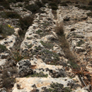
- Tan-Nadur 1: 35.901584 14.370949, poorly defined
- Tan-Nadur 2: 35.901710 14.372622
- Tan-Nadur 3: 35.901698 14.372617
- Tan-Nadur 4a: 35.901721 14.372319
- Tan-Nadur 4b: 35.901685 14.372621
- Tan-Nadur 5a: 35.901702 14.372310
- Tan-Nadur 5b: 35.901660 14.372636
- Tan-Nadur 6a: 35.901678 14.372292
- Tan-Nadur 6b: 35.901634 14.372645
- Tan-Nadur 7: 35.901593 14.372656
- Tan-Nadur 8a: 35.901507 14.372549, poorly visible
- Tan-Nadur 8b: 35.901476 14.372690, poorly visible
- Tan-Nadur 9: 35.901486 14.372526
- Tan-Nadur 10: 35.898744 14.369675
- Tan-Nadur 11: 35.899777 14.368102
- Tan-Nadur 12: 35.898321 14.366580, poorly defined
Tas-Santi
Six parallel running cart ruts which are divided into two groups by a stone wall.
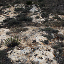
- Tas-Santi 1: 35.900489 14.363875, since 2017 destroyed by illegal bird trapping site
- Tas-Santi 2: 35.900542 14.363983, since 2017 destroyed by illegal bird trapping site
- Tas-Santi 3: 35.900435 14.364016
- Tas-Santi 4: 35.900457 14.364057
- Tas-Santi 5: 35.900467 14.364131, poorly defined
- Tas-Santi 6: 35.900396 14.364083, poorly defined
- Tas-Santi 7: 35.899724 14.360908
- Tas-Santi 8: 35.899213 14.361564, poorly visible, covered with sand
© Monika I. Trinkler

